This weather event on May 21, 2024 includes:
3 states
9 counties,
28 cities,
and 91 zip codes.
There were total properties that were impacted and have possible damage.
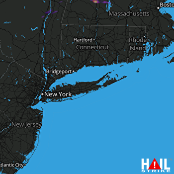 NEW YORK CITY (KOKX) RADAR
States Impacted By Hail On May 21, 2024
Massachusetts
·
New York
·
Vermont
Counties Impacted By Hail On May 21, 2024
Berkshire, MA
·
Franklin, MA
·
Worcester, MA
·
Albany, NY
·
Columbia, NY
·
Greene, NY
·
Rensselaer, NY
·
Bennington, VT
·
Windham, VT
Cities Impacted By Hail On May 21, 2024
Albany, NY
·
Altamont, NY
·
Athens, NY
·
Averill Park, NY
·
Baldwinville, MA
·
Coxsackie, NY
·
Deerfield, MA
·
East Nassau, NY
·
Gardner, MA
·
Ghent, NY
·
Greenfield Town, MA
·
Hampton Manor, NY
·
Hudson, NY
·
Leeds, NY
·
Lorenz Park, NY
·
Millers Falls, MA
·
Orange, MA
·
Palenville, NY
·
Rensselaer, NY
·
Shelburne Falls, MA
·
South Ashburnham, MA
·
South Deerfield, MA
·
Stottville, NY
·
Turners Falls, MA
·
Voorheesville, NY
·
West Sand Lake, NY
·
Williamstown, MA
·
Wilmington, VT
Zip Codes Impacted By Hail On May 21, 2024
1054
·
1072
·
1267
·
1301
·
1330
·
1337
·
1338
·
1339
·
1340
·
1341
·
1342
·
1344
·
1346
·
1347
·
1349
·
1351
·
1354
·
1355
·
1360
·
1366
·
1370
·
1373
·
1375
·
1376
·
1378
·
1379
·
1430
·
1436
·
1438
·
1440
·
1468
·
1473
·
1475
·
5301
·
5342
·
5354
·
5358
·
5361
·
5363
·
12009
·
12015
·
12018
·
12022
·
12023
·
12024
·
12037
·
12040
·
12041
·
12051
·
12054
·
12058
·
12059
·
12060
·
12061
·
12062
·
12075
·
12077
·
12084
·
12085
·
12106
·
12115
·
12123
·
12144
·
12147
·
12153
·
12159
·
12169
·
12172
·
12173
·
12174
·
12184
·
12186
·
12193
·
12195
·
12196
·
12198
·
12202
·
12207
·
12209
·
12303
·
12306
·
12413
·
12414
·
12436
·
12451
·
12463
·
12534
·
12138
·
12136
·
12067
·
1364

