This weather event on May 21, 2024 includes:
4 states
18 counties,
15 cities,
and 92 zip codes.
There were 838 total properties that were impacted and have possible damage.
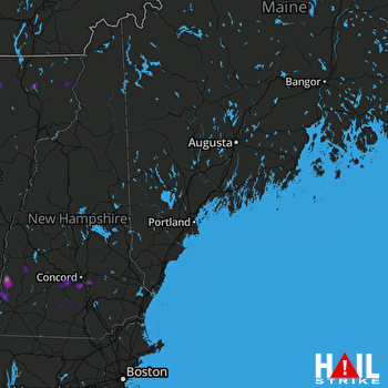 PORTLAND (KGYX) RADAR
States Impacted By Hail On May 21, 2024
Massachusetts
·
Maine
·
New Hampshire
·
Vermont
Counties Impacted By Hail On May 21, 2024
Franklin, MA
·
York, ME
·
Belknap, NH
·
Carroll, NH
·
Cheshire, NH
·
Coos, NH
·
Hillsborough, NH
·
Merrimack, NH
·
Rockingham, NH
·
Strafford, NH
·
Sullivan, NH
·
Caledonia, VT
·
Essex, VT
·
Franklin, VT
·
Lamoille, VT
·
Orleans, VT
·
Windham, VT
·
Windsor, VT
Cities Impacted By Hail On May 21, 2024
Charlestown, NH
·
Concord, NH
·
Contoocook, NH
·
Enosburg Falls, VT
·
Goffstown, NH
·
Henniker, NH
·
Londonderry, NH
·
Lowell, VT
·
Newport, NH
·
North Westminster, VT
·
Pinardville, NH
·
Saxtons River, VT
·
Union, NH
·
Walpole, NH
·
Westminster, VT
Zip Codes Impacted By Hail On May 21, 2024
1337
·
1355
·
1379
·
3032
·
3034
·
3038
·
3042
·
3043
·
3045
·
3046
·
3053
·
3102
·
3110
·
3218
·
3225
·
3229
·
3234
·
3242
·
3258
·
3263
·
3275
·
3280
·
3281
·
3301
·
3304
·
3431
·
3442
·
3464
·
3579
·
3588
·
3590
·
3601
·
3602
·
3603
·
3604
·
3605
·
3607
·
3608
·
3609
·
3743
·
3752
·
3773
·
3811
·
3840
·
3841
·
3851
·
3852
·
3855
·
3856
·
3857
·
3862
·
3884
·
3885
·
3887
·
4001
·
5101
·
5141
·
5143
·
5146
·
5148
·
5154
·
5156
·
5158
·
5343
·
5346
·
5359
·
5441
·
5442
·
5448
·
5450
·
5492
·
5652
·
5822
·
5825
·
5833
·
5837
·
5845
·
5846
·
5847
·
5855
·
5860
·
5871
·
5872
·
5874
·
5903
·
5905
·
5907
·
5471
·
5301
·
3456
·
3244
·
3070

