This weather event on May 20, 2024 includes:
3 states
17 counties,
26 cities,
and 71 zip codes.
There were total properties that were impacted and have possible damage.
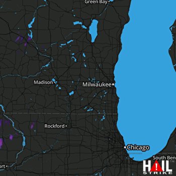 MILWAUKEE (KMKX) RADAR
States Impacted By Hail On May 20, 2024
Iowa
·
Illinois
·
Wisconsin
Counties Impacted By Hail On May 20, 2024
Cedar, IA
·
Clinton, IA
·
Delaware, IA
·
Dubuque, IA
·
Jackson, IA
·
Jones, IA
·
Scott, IA
·
Carroll, IL
·
Jo Daviess, IL
·
Stephenson, IL
·
Adams, WI
·
Grant, WI
·
Juneau, WI
·
Lafayette, WI
·
Monroe, WI
·
Sauk, WI
·
Vernon, WI
Cities Impacted By Hail On May 20, 2024
Bankston, IA
·
Bernard, IA
·
Calamus, IA
·
Camp Douglas, WI
·
Cascade, IA
·
Center Junction, IA
·
Delmar, IA
·
Dixon, IA
·
Dubuque, IA
·
Epworth, IA
·
Galena, IL
·
Hustler, WI
·
La Motte, IA
·
Lost Nation, IA
·
Lowden, IA
·
Maquoketa, IA
·
Mauston, WI
·
Monmouth, IA
·
Monticello, IA
·
New Lisbon, WI
·
Oxford Junction, IA
·
Spragueville, IA
·
St. Donatus, IA
·
Toronto, IA
·
Union Center, WI
·
Wheatland, IA
Zip Codes Impacted By Hail On May 20, 2024
52003
·
52031
·
52032
·
52033
·
52035
·
52039
·
52040
·
52041
·
52045
·
52053
·
52054
·
52060
·
52064
·
52068
·
52069
·
52074
·
52079
·
52205
·
52207
·
52212
·
52216
·
52223
·
52237
·
52254
·
52255
·
52309
·
52310
·
52320
·
52321
·
52323
·
52362
·
52721
·
52729
·
52731
·
52745
·
52751
·
52765
·
52769
·
52773
·
52777
·
53530
·
53804
·
53810
·
53929
·
53934
·
53936
·
53941
·
53948
·
53950
·
53952
·
53965
·
53968
·
54618
·
54634
·
54637
·
54638
·
54639
·
54646
·
54656
·
61025
·
61028
·
61036
·
61041
·
61044
·
61048
·
61053
·
61062
·
61074
·
61085
·
52037
·
53541

