This weather event on May 19, 2024 includes:
2 states
21 counties,
13 cities,
and 70 zip codes.
There were 475 total properties that were impacted and have possible damage.
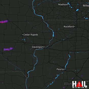 DAVENPORT (KDVN) RADAR
States Impacted By Hail On May 19, 2024
Iowa
·
Illinois
Counties Impacted By Hail On May 19, 2024
Benton, IA
·
Black Hawk, IA
·
Butler, IA
·
Grundy, IA
·
Hardin, IA
·
Iowa, IA
·
Jasper, IA
·
Keokuk, IA
·
Mahaska, IA
·
Marshall, IA
·
Poweshiek, IA
·
Tama, IA
·
De Witt, IL
·
Ford, IL
·
Logan, IL
·
Macon, IL
·
Mason, IL
·
McLean, IL
·
Menard, IL
·
Piatt, IL
·
Tazewell, IL
Cities Impacted By Hail On May 19, 2024
Bloomington, IL
·
Cedar Falls, IA
·
Dike, IA
·
Eldora, IA
·
Ellsworth, IL
·
Ferguson, IA
·
Gibson, IA
·
Hudson, IA
·
Keswick, IA
·
Steamboat Rock, IA
·
Thornburg, IA
·
Waterloo, IA
·
Wellsburg, IA
Zip Codes Impacted By Hail On May 19, 2024
50027
·
50028
·
50078
·
50104
·
50106
·
50112
·
50120
·
50126
·
50135
·
50136
·
50157
·
50158
·
50171
·
50206
·
50207
·
50208
·
50255
·
50268
·
50601
·
50613
·
50621
·
50624
·
50626
·
50627
·
50638
·
50642
·
50651
·
50660
·
50665
·
50669
·
50672
·
50675
·
50680
·
50701
·
50702
·
50703
·
50707
·
52222
·
52224
·
52316
·
52335
·
52355
·
52586
·
60936
·
61567
·
61701
·
61704
·
61705
·
61721
·
61723
·
61735
·
61736
·
61737
·
61752
·
61754
·
61756
·
61773
·
61774
·
61830
·
61839
·
61842
·
61882
·
62613
·
62634
·
62642
·
62644
·
50141
·
50612
·
50643
·
62501

