This weather event on May 19, 2024 includes:
3 states
14 counties,
17 cities,
and 69 zip codes.
There were 56 total properties that were impacted and have possible damage.
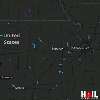 TOPEKA (KTWX) RADAR
States Impacted By Hail On May 19, 2024
Iowa
·
Kansas
·
Nebraska
Counties Impacted By Hail On May 19, 2024
Mills, IA
·
Cloud, KS
·
Marshall, KS
·
Republic, KS
·
Washington, KS
·
Cass, NE
·
Fillmore, NE
·
Gage, NE
·
Jefferson, NE
·
Lancaster, NE
·
Otoe, NE
·
Saline, NE
·
Seward, NE
·
Thayer, NE
Cities Impacted By Hail On May 19, 2024
Alexandria, NE
·
Alvo, NE
·
Concordia, KS
·
Garland, NE
·
Glasco, KS
·
Jansen, NE
·
Lincoln, NE
·
Malcolm, NE
·
Manley, NE
·
Murdock, NE
·
Murray, NE
·
Raymond, NE
·
Reynolds, NE
·
Seward, NE
·
Swanton, NE
·
Waverly, NE
·
Weeping Water, NE
Zip Codes Impacted By Hail On May 19, 2024
51534
·
51561
·
66508
·
66518
·
66901
·
66940
·
66943
·
66944
·
66953
·
66960
·
67417
·
67445
·
68003
·
68037
·
68048
·
68065
·
68304
·
68307
·
68310
·
68314
·
68315
·
68322
·
68336
·
68338
·
68341
·
68342
·
68346
·
68347
·
68349
·
68352
·
68360
·
68366
·
68370
·
68375
·
68377
·
68402
·
68403
·
68407
·
68409
·
68410
·
68413
·
68415
·
68417
·
68423
·
68424
·
68428
·
68434
·
68439
·
68445
·
68446
·
68454
·
68456
·
68463
·
68464
·
68465
·
68503
·
68504
·
68505
·
68507
·
68514
·
68517
·
68521
·
68524
·
68527
·
68528
·
68531
·
68508
·
68462
·
68303

