This weather event on May 18, 2024 includes:
2 states
26 counties,
14 cities,
and 66 zip codes.
There were 193 total properties that were impacted and have possible damage.
States Impacted By Hail On May 18, 2024
Colorado
·
Kansas
Counties Impacted By Hail On May 18, 2024
Kiowa, CO
·
Prowers, CO
·
Decatur, KS
·
Ellis, KS
·
Finney, KS
·
Gove, KS
·
Graham, KS
·
Gray, KS
·
Greeley, KS
·
Hamilton, KS
·
Hodgeman, KS
·
Kearny, KS
·
Lane, KS
·
Logan, KS
·
Ness, KS
·
Norton, KS
·
Phillips, KS
·
Rawlins, KS
·
Rooks, KS
·
Rush, KS
·
Scott, KS
·
Sheridan, KS
·
Thomas, KS
·
Trego, KS
·
Wallace, KS
·
Wichita, KS
Cities Impacted By Hail On May 18, 2024
Clayton, KS
·
Colby, KS
·
Coolidge, KS
·
Granada, CO
·
Greeley County unified government (balance), KS
·
Hartman, CO
·
Healy, KS
·
Holly, CO
·
Jennings, KS
·
Menlo, KS
·
Ransom, KS
·
Rexford, KS
·
Scott City, KS
·
Selden, KS
Zip Codes Impacted By Hail On May 18, 2024
67515
·
67518
·
67520
·
67548
·
67556
·
67560
·
67565
·
67572
·
67584
·
67622
·
67629
·
67631
·
67635
·
67637
·
67639
·
67642
·
67643
·
67645
·
67646
·
67650
·
67654
·
67656
·
67657
·
67659
·
67660
·
67661
·
67663
·
67664
·
67669
·
67671
·
67672
·
67701
·
67730
·
67734
·
67736
·
67737
·
67738
·
67739
·
67740
·
67744
·
67748
·
67749
·
67751
·
67752
·
67753
·
67757
·
67758
·
67764
·
67835
·
67836
·
67838
·
67839
·
67849
·
67850
·
67851
·
67853
·
67854
·
67861
·
67871
·
67878
·
67879
·
81041
·
81043
·
81047
·
81052
·
81071
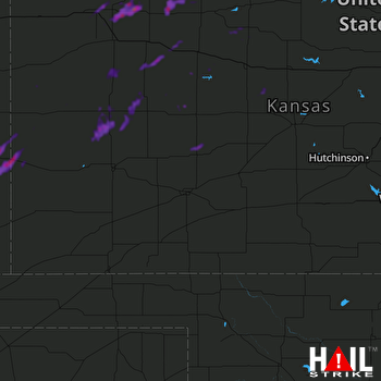 DODGE CITY (KDDC) RADAR

