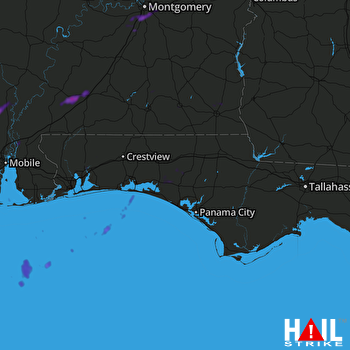
This weather event on May 18, 2024 includes:
2 states
23 counties,
27 cities,
and 65 zip codes.
There were 77 total properties that were impacted and have possible damage.
States Impacted By Hail On May 18, 2024
Alabama
·
Florida
Counties Impacted By Hail On May 18, 2024
Baldwin, AL
·
Clarke, AL
·
Coffee, AL
·
Conecuh, AL
·
Covington, AL
·
Crenshaw, AL
·
Dale, AL
·
Escambia, AL
·
Geneva, AL
·
Henry, AL
·
Houston, AL
·
Lee, AL
·
Lowndes, AL
·
Macon, AL
·
Monroe, AL
·
Montgomery, AL
·
Tallapoosa, AL
·
Washington, AL
·
Holmes, FL
·
Okaloosa, FL
·
Santa Rosa, FL
·
Walton, FL
·
Washington, FL
Cities Impacted By Hail On May 18, 2024
Andalusia, AL
·
Auburn, AL
·
DeFuniak Springs, FL
·
Dixonville, FL
·
Dothan, AL
·
Eglin AFB, FL
·
Enterprise, AL
·
Evergreen, AL
·
Excel, AL
·
Franklin, AL
·
Freeport, FL
·
Harold, FL
·
Headland, AL
·
Kinsey, AL
·
Milton, FL
·
Montgomery, AL
·
Munson, FL
·
Pike Road, AL
·
Point Baker, FL
·
Ponce de Leon, FL
·
Repton, AL
·
River Falls, AL
·
Shorter, AL
·
Sims Chapel, AL
·
Springhill, FL
·
Stockton, AL
·
Tuskegee, AL
Zip Codes Impacted By Hail On May 18, 2024
32413
·
32427
·
32433
·
32435
·
32437
·
32439
·
32455
·
32459
·
32462
·
32531
·
32539
·
32564
·
32565
·
32567
·
32579
·
32583
·
36009
·
36028
·
36040
·
36043
·
36047
·
36049
·
36064
·
36078
·
36083
·
36105
·
36106
·
36108
·
36109
·
36111
·
36117
·
36303
·
36316
·
36323
·
36330
·
36345
·
36350
·
36401
·
36421
·
36426
·
36432
·
36442
·
36445
·
36453
·
36454
·
36460
·
36474
·
36475
·
36480
·
36507
·
36522
·
36529
·
36545
·
36553
·
36579
·
36581
·
36583
·
36585
·
36752
·
36804
·
36830
·
36874
·
32570
·
36075
·
36116
 EGLIN AFB (KEVX) RADAR

