This weather event on May 17, 2024 includes:
2 states
23 counties,
24 cities,
and 75 zip codes.
There were 481 total properties that were impacted and have possible damage.
States Impacted By Hail On May 17, 2024
Illinois
·
Missouri
Counties Impacted By Hail On May 17, 2024
Cass, IL
·
De Witt, IL
·
Logan, IL
·
Macoupin, IL
·
Madison, IL
·
Mason, IL
·
Menard, IL
·
Piatt, IL
·
St. Clair, IL
·
Audrain, MO
·
Camden, MO
·
Crawford, MO
·
Dent, MO
·
Franklin, MO
·
Gasconade, MO
·
Iron, MO
·
Laclede, MO
·
Osage, MO
·
Phelps, MO
·
Pulaski, MO
·
Reynolds, MO
·
Shannon, MO
·
Texas, MO
Cities Impacted By Hail On May 17, 2024
Beason, IL
·
Bunker, MO
·
Caseyville, IL
·
Collinsville, IL
·
Doolittle, MO
·
Edgar Springs, MO
·
Elkhart, IL
·
Evergreen, MO
·
Fairmont City, IL
·
Fairview Heights, IL
·
Fort Leonard Wood, MO
·
Gerald, MO
·
Granite City, IL
·
Lincoln, IL
·
Madison, IL
·
Middletown, IL
·
Newburg, MO
·
Owensville, MO
·
Raymondville, MO
·
Rolla, MO
·
Standard City, IL
·
St. Robert, MO
·
Waynesville, MO
·
Weldon, IL
Zip Codes Impacted By Hail On May 17, 2024
61727
·
61735
·
61749
·
61756
·
61777
·
61830
·
61882
·
62040
·
62048
·
62204
·
62208
·
62232
·
62234
·
62512
·
62548
·
62613
·
62627
·
62633
·
62634
·
62640
·
62642
·
62643
·
62656
·
62664
·
62666
·
62673
·
62675
·
62693
·
63013
·
63037
·
63056
·
63080
·
63084
·
63091
·
63620
·
63621
·
63625
·
63629
·
63633
·
63650
·
63665
·
63675
·
65013
·
65014
·
65051
·
65066
·
65265
·
65280
·
65401
·
65440
·
65446
·
65449
·
65457
·
65461
·
65462
·
65473
·
65479
·
65501
·
65536
·
65542
·
65550
·
65552
·
65555
·
65556
·
65559
·
65560
·
65565
·
65583
·
65584
·
65662
·
65711
·
65567
·
63077
·
62655
·
62572
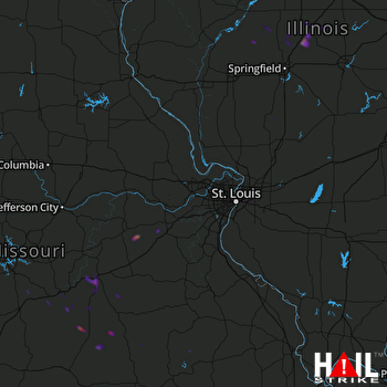 ST LOUIS (KLSX) RADAR

