This weather event on May 17, 2024 includes:
3 states
23 counties,
24 cities,
and 53 zip codes.
There were total properties that were impacted and have possible damage.
States Impacted By Hail On May 17, 2024
Alabama
·
Florida
·
Georgia
Counties Impacted By Hail On May 17, 2024
Autauga, AL
·
Covington, AL
·
Escambia, AL
·
Geneva, AL
·
Hale, AL
·
Monroe, AL
·
Perry, AL
·
Gadsden, FL
·
Holmes, FL
·
Jackson, FL
·
Liberty, FL
·
Okaloosa, FL
·
Washington, FL
·
Baker, GA
·
Colquitt, GA
·
Crisp, GA
·
Decatur, GA
·
Lee, GA
·
Mitchell, GA
·
Seminole, GA
·
Thomas, GA
·
Turner, GA
·
Worth, GA
Cities Impacted By Hail On May 17, 2024
Ashburn, GA
·
Black, AL
·
Bonifay, FL
·
Brewton, AL
·
Camilla, GA
·
Chattahoochee, FL
·
East Brewton, AL
·
Esto, FL
·
Eunola, AL
·
Geneva, AL
·
Graceville, FL
·
Grand Ridge, FL
·
Greenwood, FL
·
Jacob City, FL
·
Leesburg, GA
·
Marianna, FL
·
Newbern, AL
·
Newton, GA
·
Noma, FL
·
Pelham, GA
·
Prattville, AL
·
Riverview, AL
·
Sneads, FL
·
Uriah, AL
Zip Codes Impacted By Hail On May 17, 2024
31712
·
31714
·
31716
·
31730
·
31756
·
31763
·
31765
·
31768
·
31779
·
31783
·
31784
·
31790
·
32321
·
32324
·
32351
·
32352
·
32425
·
32426
·
32427
·
32428
·
32431
·
32432
·
32440
·
32442
·
32443
·
32446
·
32448
·
32460
·
32464
·
32531
·
36003
·
36067
·
36313
·
36314
·
36322
·
36340
·
36344
·
36420
·
36426
·
36442
·
36453
·
36477
·
36480
·
36483
·
36502
·
36756
·
36765
·
36786
·
39845
·
39870
·
39819
·
31796
·
31721
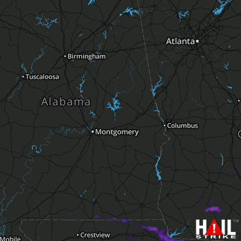 MONTGOMERY (KMXX) RADAR

