This weather event on May 15, 2024 includes:
1 states
25 counties,
17 cities,
and 72 zip codes.
There were 71 total properties that were impacted and have possible damage.
States Impacted By Hail On May 15, 2024
Texas
Counties Impacted By Hail On May 15, 2024
Baylor, TX
·
Bell, TX
·
Bosque, TX
·
Brazos, TX
·
Burleson, TX
·
Burnet, TX
·
Comanche, TX
·
Eastland, TX
·
Erath, TX
·
Hamilton, TX
·
Haskell, TX
·
Jack, TX
·
Johnson, TX
·
Knox, TX
·
Lampasas, TX
·
Lee, TX
·
Llano, TX
·
Milam, TX
·
Palo Pinto, TX
·
Robertson, TX
·
San Saba, TX
·
Throckmorton, TX
·
Williamson, TX
·
Wise, TX
·
Young, TX
Cities Impacted By Hail On May 15, 2024
Brushy Creek, TX
·
Bryan, TX
·
Buchanan Dam, TX
·
Burnet, TX
·
Calvert, TX
·
Cedar Park, TX
·
Cleburne, TX
·
Cranfills Gap, TX
·
De Leon, TX
·
Georgetown, TX
·
Gordon, TX
·
Jarrell, TX
·
Kingsland, TX
·
Leander, TX
·
Mingus, TX
·
Round Rock, TX
·
Serenada, TX
Zip Codes Impacted By Hail On May 15, 2024
76031
·
76033
·
76036
·
76058
·
76067
·
76270
·
76371
·
76372
·
76380
·
76388
·
76401
·
76429
·
76431
·
76442
·
76444
·
76446
·
76449
·
76450
·
76453
·
76454
·
76457
·
76458
·
76470
·
76472
·
76475
·
76483
·
76491
·
76511
·
76518
·
76520
·
76525
·
76527
·
76530
·
76534
·
76537
·
76538
·
76550
·
76567
·
76571
·
76574
·
76577
·
76578
·
76634
·
76637
·
76652
·
76824
·
76853
·
76877
·
77807
·
77836
·
77837
·
78605
·
78607
·
78609
·
78611
·
78613
·
78615
·
78626
·
78633
·
78634
·
78639
·
78641
·
78643
·
78664
·
78665
·
78672
·
78681
·
78947
·
76363
·
76445
·
76463
·
78628
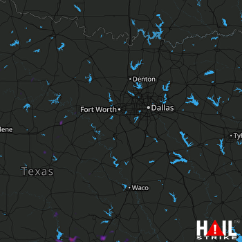 DALLAS/FTW (KFWS) RADAR

