This weather event on May 15, 2024 includes:
1 states
17 counties,
25 cities,
and 73 zip codes.
There were 65564 total properties that were impacted and have possible damage.
States Impacted By Hail On May 15, 2024
Texas
Counties Impacted By Hail On May 15, 2024
Bastrop, TX
·
Bell, TX
·
Brazos, TX
·
Burleson, TX
·
Burnet, TX
·
Coryell, TX
·
Hamilton, TX
·
Hays, TX
·
Lampasas, TX
·
Lee, TX
·
Llano, TX
·
Milam, TX
·
Robertson, TX
·
San Saba, TX
·
Travis, TX
·
Washington, TX
·
Williamson, TX
Cities Impacted By Hail On May 15, 2024
Briarcliff, TX
·
Brushy Creek, TX
·
Buchanan Dam, TX
·
Buchanan Lake Village, TX
·
Burnet, TX
·
Cedar Park, TX
·
Elgin, TX
·
Georgetown, TX
·
Granger, TX
·
Hudson Bend, TX
·
Hutto, TX
·
Jarrell, TX
·
Jonestown, TX
·
Lago Vista, TX
·
Lakeway, TX
·
Leander, TX
·
Llano, TX
·
Pflugerville, TX
·
Point Venture, TX
·
Round Rock, TX
·
Taylor, TX
·
Thorndale, TX
·
Volente, TX
·
Weir, TX
·
Wyldwood, TX
Zip Codes Impacted By Hail On May 15, 2024
76457
·
76511
·
76518
·
76520
·
76522
·
76527
·
76528
·
76530
·
76531
·
76534
·
76537
·
76538
·
76550
·
76556
·
76567
·
76571
·
76573
·
76574
·
76577
·
76578
·
76637
·
76824
·
76832
·
76853
·
76877
·
76885
·
77833
·
77836
·
77853
·
77857
·
77859
·
77868
·
77878
·
77879
·
77880
·
78602
·
78605
·
78607
·
78609
·
78611
·
78612
·
78613
·
78620
·
78621
·
78626
·
78628
·
78633
·
78634
·
78639
·
78641
·
78643
·
78645
·
78650
·
78654
·
78660
·
78663
·
78664
·
78665
·
78669
·
78672
·
78681
·
78717
·
78726
·
78727
·
78728
·
78729
·
78732
·
78734
·
78738
·
78750
·
78942
·
78946
·
78947
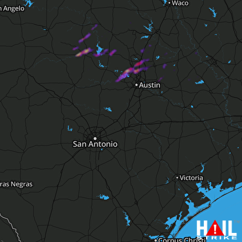 SAN ANTONIO (KEWX) RADAR

