This weather event on May 15, 2024 includes:
3 states
22 counties,
18 cities,
and 50 zip codes.
There were 104 total properties that were impacted and have possible damage.
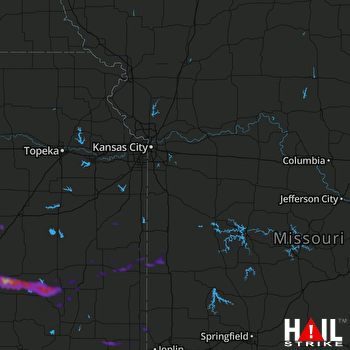 KANSAS CITY (KEAX) RADAR
States Impacted By Hail On May 15, 2024
Kansas
·
Missouri
·
Oklahoma
Counties Impacted By Hail On May 15, 2024
Allen, KS
·
Anderson, KS
·
Bourbon, KS
·
Butler, KS
·
Chase, KS
·
Cherokee, KS
·
Elk, KS
·
Geary, KS
·
Greenwood, KS
·
Labette, KS
·
Linn, KS
·
Miami, KS
·
Neosho, KS
·
Riley, KS
·
Wilson, KS
·
Woodson, KS
·
Bates, MO
·
Cedar, MO
·
Jasper, MO
·
Lafayette, MO
·
Vernon, MO
·
Craig, OK
Cities Impacted By Hail On May 15, 2024
Asbury, MO
·
Bronson, KS
·
Buffalo, KS
·
Chanute, KS
·
Climax, KS
·
Columbus, KS
·
Coyville, KS
·
Eureka, KS
·
Fredonia, KS
·
Fulton, KS
·
Metz, MO
·
Oswego, KS
·
Parker, KS
·
Prescott, KS
·
Richards, MO
·
Stotesbury, MO
·
Umber View Heights, MO
·
Weir, KS
Zip Codes Impacted By Hail On May 15, 2024
64001
·
64750
·
64752
·
64756
·
64765
·
64778
·
64779
·
64783
·
64832
·
65785
·
66033
·
66040
·
66053
·
66072
·
66075
·
66701
·
66710
·
66714
·
66716
·
66717
·
66720
·
66725
·
66732
·
66736
·
66738
·
66748
·
66749
·
66751
·
66754
·
66755
·
66762
·
66767
·
66769
·
66777
·
66779
·
66781
·
66783
·
66801
·
66845
·
67045
·
67047
·
67074
·
67122
·
67132
·
67137
·
67330
·
67336
·
67356
·
74333
·
74369

