This weather event on May 14, 2024 includes:
2 states
21 counties,
13 cities,
and 47 zip codes.
There were 212 total properties that were impacted and have possible damage.
States Impacted By Hail On May 14, 2024
Georgia
·
South Carolina
Counties Impacted By Hail On May 14, 2024
Clarke, GA
·
Columbia, GA
·
Greene, GA
·
Lincoln, GA
·
Madison, GA
·
Morgan, GA
·
Oconee, GA
·
Oglethorpe, GA
·
Putnam, GA
·
Taliaferro, GA
·
Wilkes, GA
·
Berkeley, SC
·
Charleston, SC
·
Colleton, SC
·
Edgefield, SC
·
Georgetown, SC
·
Jasper, SC
·
McCormick, SC
·
Orangeburg, SC
·
Richland, SC
·
Saluda, SC
Cities Impacted By Hail On May 14, 2024
Athens-Clarke County unified government (balance), GA
·
Buckhead, GA
·
Edgefield, SC
·
Goose Creek, SC
·
Greensboro, GA
·
Hull, GA
·
Johnston, SC
·
McClellanville, SC
·
Modoc, SC
·
Union Point, GA
·
Washington, GA
·
Winterville, GA
·
Woodville, GA
Zip Codes Impacted By Hail On May 14, 2024
29016
·
29048
·
29059
·
29129
·
29138
·
29166
·
29406
·
29423
·
29429
·
29436
·
29440
·
29445
·
29450
·
29453
·
29458
·
29461
·
29472
·
29474
·
29483
·
29821
·
29824
·
29832
·
29835
·
29838
·
29844
·
29845
·
29847
·
29916
·
29936
·
30601
·
30605
·
30621
·
30625
·
30628
·
30631
·
30642
·
30646
·
30650
·
30660
·
30669
·
30673
·
30677
·
30683
·
30802
·
30817
·
31024
·
29456
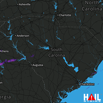 COLUMBIA (KCAE) RADAR

