This weather event on May 13, 2024 includes:
2 states
14 counties,
29 cities,
and 66 zip codes.
There were 1135 total properties that were impacted and have possible damage.
States Impacted By Hail On May 13, 2024
Illinois
·
Indiana
Counties Impacted By Hail On May 13, 2024
Cook, IL
·
Iroquois, IL
·
Kankakee, IL
·
Will, IL
·
Fulton, IN
·
Jasper, IN
·
Lake, IN
·
LaPorte, IN
·
Marshall, IN
·
Newton, IN
·
Porter, IN
·
Pulaski, IN
·
Starke, IN
·
St. Joseph, IN
Cities Impacted By Hail On May 13, 2024
Alsip, IL
·
Argos, IN
·
Bass Lake, IN
·
Blue Island, IL
·
Braidwood, IL
·
Chicago Ridge, IL
·
Crest Hill, IL
·
Culver, IN
·
Evergreen Park, IL
·
Fairmont, IL
·
Fish Lake, IN
·
Gary, IN
·
Lake Station, IN
·
Lakewood Shores, IL
·
Lockport, IL
·
Medaryville, IN
·
Merrionette Park, IL
·
Mishawaka, IN
·
Monterey, IN
·
Morocco, IN
·
Oak Lawn, IL
·
Ogden Dunes, IN
·
Palos Heights, IL
·
Portage, IN
·
Preston Heights, IL
·
Rockdale, IL
·
Roselawn, IN
·
Shorewood, IL
·
Worth, IL
Zip Codes Impacted By Hail On May 13, 2024
46310
·
46341
·
46349
·
46350
·
46365
·
46366
·
46368
·
46381
·
46385
·
46392
·
46402
·
46403
·
46404
·
46405
·
46406
·
46407
·
46501
·
46504
·
46511
·
46534
·
46544
·
46554
·
46570
·
46574
·
46614
·
46968
·
46975
·
46996
·
47922
·
47943
·
47946
·
47951
·
47963
·
47978
·
60403
·
60404
·
60406
·
60408
·
60410
·
60415
·
60421
·
60431
·
60432
·
60433
·
60435
·
60436
·
60441
·
60442
·
60453
·
60463
·
60481
·
60482
·
60643
·
60655
·
60803
·
60805
·
60912
·
60914
·
60918
·
60924
·
60931
·
60935
·
60950
·
60955
·
46960
·
47957
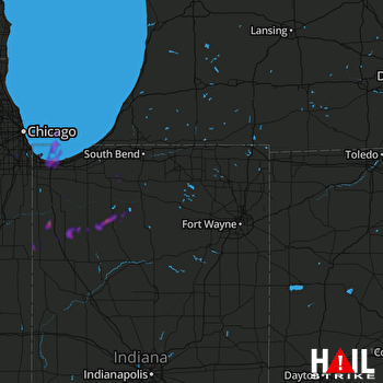 FORT WAYNE (KIWX) RADAR

