This weather event on May 12, 2024 includes:
1 states
39 counties,
18 cities,
and 78 zip codes.
There were 37 total properties that were impacted and have possible damage.
States Impacted By Hail On May 12, 2024
Texas
Counties Impacted By Hail On May 12, 2024
Borden, TX
·
Brown, TX
·
Burnet, TX
·
Callahan, TX
·
Coke, TX
·
Coleman, TX
·
Comanche, TX
·
Concho, TX
·
Coryell, TX
·
Crosby, TX
·
Dickens, TX
·
Fisher, TX
·
Garza, TX
·
Hamilton, TX
·
Haskell, TX
·
Howard, TX
·
Irion, TX
·
Jones, TX
·
Kent, TX
·
Kimble, TX
·
King, TX
·
Lampasas, TX
·
Mason, TX
·
McCulloch, TX
·
Menard, TX
·
Mills, TX
·
Mitchell, TX
·
Reagan, TX
·
Runnels, TX
·
San Saba, TX
·
Scurry, TX
·
Shackelford, TX
·
Stephens, TX
·
Stonewall, TX
·
Sutton, TX
·
Taylor, TX
·
Throckmorton, TX
·
Tom Green, TX
·
Young, TX
Cities Impacted By Hail On May 12, 2024
Albany, TX
·
Brownwood, TX
·
Carlsbad, TX
·
Early, TX
·
Goldthwaite, TX
·
Hamilton, TX
·
Haskell, TX
·
Lampasas, TX
·
Lometa, TX
·
Mertzon, TX
·
Post, TX
·
Richland Springs, TX
·
Rotan, TX
·
San Angelo, TX
·
San Saba, TX
·
Snyder, TX
·
Stamford, TX
·
Thunderbird Bay, TX
Zip Codes Impacted By Hail On May 12, 2024
76388
·
76424
·
76430
·
76432
·
76436
·
76442
·
76446
·
76452
·
76455
·
76464
·
76474
·
76483
·
76522
·
76528
·
76531
·
76539
·
76550
·
76801
·
76802
·
76824
·
76825
·
76827
·
76832
·
76837
·
76841
·
76842
·
76844
·
76848
·
76849
·
76853
·
76854
·
76856
·
76857
·
76858
·
76859
·
76869
·
76871
·
76872
·
76877
·
76882
·
76887
·
76890
·
76901
·
76904
·
76930
·
76934
·
76941
·
76950
·
76953
·
79356
·
79370
·
79501
·
79502
·
79504
·
79510
·
79511
·
79512
·
79518
·
79520
·
79521
·
79526
·
79527
·
79528
·
79530
·
79540
·
79541
·
79544
·
79546
·
79547
·
79548
·
79549
·
79553
·
79562
·
79565
·
79567
·
79602
·
79720
·
76905
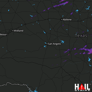 SAN ANGELO (KSJT) RADAR

