This weather event on May 11, 2024 includes:
3 states
26 counties,
15 cities,
and 58 zip codes.
There were 2645 total properties that were impacted and have possible damage.
States Impacted By Hail On May 11, 2024
Louisiana
·
Mississippi
·
Texas
Counties Impacted By Hail On May 11, 2024
Allen, LA
·
Beauregard, LA
·
Calcasieu, LA
·
Catahoula, LA
·
Concordia, LA
·
Iberville, LA
·
Jefferson Davis, LA
·
Pointe Coupee, LA
·
Rapides, LA
·
Sabine, LA
·
St. Landry, LA
·
St. Martin, LA
·
Vernon, LA
·
West Baton Rouge, LA
·
Amite, MS
·
Angelina, TX
·
Hardin, TX
·
Jasper, TX
·
Liberty, TX
·
Newton, TX
·
Panola, TX
·
Polk, TX
·
Sabine, TX
·
San Jacinto, TX
·
Trinity, TX
·
Tyler, TX
Cities Impacted By Hail On May 11, 2024
Big Thicket Lake Estates, TX
·
Coldspring, TX
·
Colmesneil, TX
·
DeQuincy, LA
·
Evadale, TX
·
Goodrich, TX
·
Groveton, TX
·
Indian Springs, TX
·
Krotz Springs, LA
·
Livingston, TX
·
Rosedale, LA
·
Shepherd, TX
·
Warren, TX
·
West Livingston, TX
·
Wildwood, TX
Zip Codes Impacted By Hail On May 11, 2024
39652
·
70611
·
70633
·
70634
·
70639
·
70647
·
70648
·
70653
·
70657
·
70658
·
70660
·
70661
·
70663
·
70750
·
70757
·
70767
·
70772
·
71343
·
71354
·
71429
·
71439
·
71446
·
71447
·
75633
·
75643
·
75669
·
75845
·
75862
·
75901
·
75926
·
75933
·
75938
·
75939
·
75941
·
75948
·
75949
·
75951
·
75956
·
75979
·
77326
·
77327
·
77328
·
77331
·
77335
·
77351
·
77358
·
77360
·
77369
·
77371
·
77612
·
77615
·
77616
·
77624
·
77625
·
77656
·
77660
·
77663
·
77664
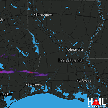 FORT POLK (KPOE) RADAR

