This weather event on May 9, 2024 includes:
2 states
20 counties,
20 cities,
and 63 zip codes.
There were 80 total properties that were impacted and have possible damage.
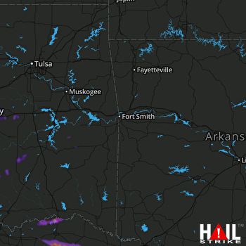 FORT SMITH (KSRX) RADAR
States Impacted By Hail On May 9, 2024
Oklahoma
·
Texas
Counties Impacted By Hail On May 9, 2024
Bryan, OK
·
Choctaw, OK
·
Coal, OK
·
Haskell, OK
·
Hughes, OK
·
Johnston, OK
·
Latimer, OK
·
Le Flore, OK
·
Lincoln, OK
·
Okfuskee, OK
·
Pittsburg, OK
·
Pontotoc, OK
·
Pottawatomie, OK
·
Seminole, OK
·
Delta, TX
·
Fannin, TX
·
Franklin, TX
·
Lamar, TX
·
Red River, TX
·
Titus, TX
Cities Impacted By Hail On May 9, 2024
Ada, OK
·
Allen, OK
·
Bogata, TX
·
Clearview, OK
·
Connerville, OK
·
Cromwell, OK
·
Deport, TX
·
Earlsboro, OK
·
Honey Grove, TX
·
IXL, OK
·
Johnson, OK
·
McAlester, OK
·
Okemah, OK
·
Paden, OK
·
Panola, OK
·
Pocola, OK
·
Prague, OK
·
Roxton, TX
·
St. Louis, OK
·
Tupelo, OK
Zip Codes Impacted By Hail On May 9, 2024
73460
·
74501
·
74531
·
74534
·
74538
·
74552
·
74561
·
74563
·
74572
·
74578
·
74723
·
74726
·
74727
·
74738
·
74743
·
74759
·
74804
·
74820
·
74825
·
74826
·
74829
·
74833
·
74836
·
74837
·
74840
·
74848
·
74852
·
74854
·
74855
·
74859
·
74860
·
74864
·
74865
·
74868
·
74871
·
74880
·
74902
·
74959
·
75411
·
75416
·
75417
·
75421
·
75426
·
75435
·
75436
·
75446
·
75447
·
75450
·
75455
·
75460
·
75462
·
75468
·
75470
·
75473
·
75477
·
75486
·
75487
·
75488
·
75492
·
75550
·
75554
·
75432
·
74570

