This weather event on May 9, 2024 includes:
2 states
25 counties,
20 cities,
and 60 zip codes.
There were total properties that were impacted and have possible damage.
States Impacted By Hail On May 9, 2024
Alabama
·
Georgia
Counties Impacted By Hail On May 9, 2024
Barbour, AL
·
Bullock, AL
·
Elmore, AL
·
Henry, AL
·
Macon, AL
·
Pike, AL
·
Russell, AL
·
Baker, GA
·
Brooks, GA
·
Calhoun, GA
·
Clay, GA
·
Colquitt, GA
·
Cook, GA
·
Dougherty, GA
·
Early, GA
·
Lee, GA
·
Mitchell, GA
·
Quitman, GA
·
Randolph, GA
·
Stewart, GA
·
Sumter, GA
·
Terrell, GA
·
Thomas, GA
·
Webster, GA
·
Worth, GA
Cities Impacted By Hail On May 9, 2024
Albany, GA
·
Baconton, GA
·
Blakely, GA
·
Camilla, GA
·
Cuthbert, GA
·
Dawson, GA
·
Doerun, GA
·
Emerald Mountain, AL
·
Eufaula, AL
·
Georgetown-Quitman County, GA
·
Leesburg, GA
·
Lumpkin, GA
·
Pelham, GA
·
Putney, GA
·
Sasser, GA
·
Shellman, GA
·
Shorter, AL
·
Sylvester, GA
·
Troy, AL
·
Webster County, GA
Zip Codes Impacted By Hail On May 9, 2024
31625
·
31626
·
31629
·
31643
·
31701
·
31705
·
31707
·
31716
·
31721
·
31730
·
31744
·
31756
·
31763
·
31765
·
31768
·
31771
·
31772
·
31779
·
31780
·
31787
·
31788
·
31791
·
31796
·
31815
·
31821
·
31825
·
31832
·
36005
·
36016
·
36017
·
36027
·
36048
·
36053
·
36075
·
36078
·
36081
·
36089
·
36093
·
36319
·
36345
·
36858
·
36871
·
36875
·
39823
·
39824
·
39826
·
39836
·
39840
·
39842
·
39846
·
39851
·
39854
·
39862
·
39866
·
39867
·
39870
·
39885
·
39886
·
31620
·
31784
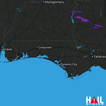 EGLIN AFB (KEVX) RADAR

