This weather event on May 7, 2024 includes:
2 states
15 counties,
35 cities,
and 61 zip codes.
There were 4733 total properties that were impacted and have possible damage.
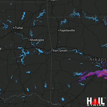 FORT SMITH (KSRX) RADAR
States Impacted By Hail On May 7, 2024
Arkansas
·
Texas
Counties Impacted By Hail On May 7, 2024
Clark, AR
·
Cleburne, AR
·
Faulkner, AR
·
Garland, AR
·
Grant, AR
·
Hot Spring, AR
·
Jefferson, AR
·
Lonoke, AR
·
Montgomery, AR
·
Perry, AR
·
Pike, AR
·
Pulaski, AR
·
Saline, AR
·
White, AR
·
Red River, TX
Cities Impacted By Hail On May 7, 2024
Alexander, AR
·
Avilla, AR
·
Bauxite, AR
·
Benton, AR
·
Bryant, AR
·
Cabot, AR
·
College Station, AR
·
East End, AR
·
England, AR
·
Fountain Lake, AR
·
Gibson, AR
·
Glenwood, AR
·
Hensley, AR
·
Hot Springs, AR
·
Hot Springs Village, AR
·
Jacksonville, AR
·
Keo, AR
·
Lake Hamilton, AR
·
Landmark, AR
·
Little Rock, AR
·
Lonsdale, AR
·
Maumelle, AR
·
Mountain Pine, AR
·
Natural Steps, AR
·
North Little Rock, AR
·
Piney, AR
·
Redfield, AR
·
Rockwell, AR
·
Salem, AR
·
Scott, AR
·
Shannon Hills, AR
·
Sweet Home, AR
·
Ward, AR
·
Woodson, AR
·
Wrightsville, AR
Zip Codes Impacted By Hail On May 7, 2024
71901
·
71909
·
71913
·
71921
·
71929
·
71933
·
71943
·
71956
·
71964
·
71968
·
72002
·
72007
·
72011
·
72015
·
72019
·
72022
·
72023
·
72032
·
72046
·
72065
·
72076
·
72079
·
72083
·
72086
·
72087
·
72103
·
72113
·
72114
·
72117
·
72118
·
72120
·
72122
·
72126
·
72132
·
72135
·
72137
·
72142
·
72143
·
72150
·
72152
·
72167
·
72168
·
72173
·
72201
·
72202
·
72204
·
72205
·
72206
·
72207
·
72209
·
72210
·
72211
·
72543
·
75417
·
75426
·
75435
·
75436
·
71602
·
71949
·
72176
·
72223

