This weather event on May 6, 2024 includes:
2 states
25 counties,
22 cities,
and 75 zip codes.
There were total properties that were impacted and have possible damage.
States Impacted By Hail On May 6, 2024
Iowa
·
Minnesota
Counties Impacted By Hail On May 6, 2024
Clay, IA
·
Dickinson, IA
·
Emmet, IA
·
Franklin, IA
·
Hancock, IA
·
Humboldt, IA
·
Kossuth, IA
·
Palo Alto, IA
·
Pocahontas, IA
·
Winnebago, IA
·
Wright, IA
·
Blue Earth, MN
·
Brown, MN
·
Cottonwood, MN
·
Faribault, MN
·
Jackson, MN
·
Le Sueur, MN
·
Martin, MN
·
McLeod, MN
·
Meeker, MN
·
Nicollet, MN
·
Redwood, MN
·
Renville, MN
·
Sibley, MN
·
Watonwan, MN
Cities Impacted By Hail On May 6, 2024
Alexander, IA
·
Amboy, MN
·
Arnolds Park, IA
·
Curlew, IA
·
Dolliver, IA
·
Dunnell, MN
·
Emmetsburg, IA
·
Garner, IA
·
Hutchinson, MN
·
Ledyard, IA
·
Le Sueur, MN
·
Mallard, IA
·
Okoboji, IA
·
Orleans, IA
·
Rake, IA
·
Sherburn, MN
·
Spirit Lake, IA
·
Superior, IA
·
Thompson, IA
·
Welcome, MN
·
Wesley, IA
·
West Bend, IA
Zip Codes Impacted By Hail On May 6, 2024
50420
·
50421
·
50438
·
50451
·
50457
·
50465
·
50478
·
50480
·
50483
·
50484
·
50511
·
50515
·
50527
·
50528
·
50531
·
50536
·
50545
·
50546
·
50556
·
50558
·
50562
·
50570
·
50578
·
50581
·
50597
·
50598
·
51331
·
51333
·
51334
·
51351
·
51355
·
51358
·
51360
·
51363
·
51366
·
55324
·
55334
·
55350
·
55355
·
55385
·
56010
·
56013
·
56019
·
56027
·
56033
·
56058
·
56060
·
56068
·
56081
·
56082
·
56083
·
56085
·
56087
·
56097
·
56111
·
56118
·
56121
·
56127
·
56143
·
56145
·
56150
·
56159
·
56162
·
56171
·
56176
·
56181
·
56224
·
56241
·
56260
·
56266
·
56285
·
56101
·
56062
·
50514
·
50424
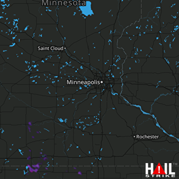 MINNEAPOLIS (KMPX) RADAR

