This weather event on May 6, 2024 includes:
3 states
24 counties,
18 cities,
and 58 zip codes.
There were 2548 total properties that were impacted and have possible damage.
States Impacted By Hail On May 6, 2024
North Carolina
·
Tennessee
·
Virginia
Counties Impacted By Hail On May 6, 2024
Alexander, NC
·
Alleghany, NC
·
Avery, NC
·
Caldwell, NC
·
Catawba, NC
·
Davie, NC
·
Forsyth, NC
·
Gaston, NC
·
Iredell, NC
·
Rockingham, NC
·
Rowan, NC
·
Stokes, NC
·
Surry, NC
·
Watauga, NC
·
Wilkes, NC
·
Carter, TN
·
Sullivan, TN
·
Montgomery, VA
·
Patrick, VA
·
Pulaski, VA
·
Radford, VA
·
Scott, VA
·
Smyth, VA
·
Washington, VA
Cities Impacted By Hail On May 6, 2024
Bloomingdale, TN
·
Cajah's Mountain, NC
·
Cedar Rock, NC
·
Clinchport, VA
·
Gamewell, NC
·
Hiddenite, NC
·
Hudson, NC
·
Lenoir, NC
·
Lowgap, NC
·
Mocksville, NC
·
Moravian Falls, NC
·
Mount Airy, NC
·
Pinnacle, NC
·
Radford, VA
·
Sawmills, NC
·
Statesville, NC
·
Stony Point, NC
·
Taylorsville, NC
Zip Codes Impacted By Hail On May 6, 2024
24053
·
24076
·
24084
·
24120
·
24162
·
24171
·
24210
·
24244
·
24251
·
24361
·
24370
·
27013
·
27017
·
27021
·
27024
·
27025
·
27028
·
27030
·
27041
·
27043
·
27045
·
27052
·
27054
·
27311
·
27326
·
28034
·
28164
·
28601
·
28606
·
28607
·
28610
·
28613
·
28618
·
28621
·
28622
·
28623
·
28624
·
28625
·
28630
·
28636
·
28638
·
28645
·
28651
·
28654
·
28659
·
28665
·
28669
·
28678
·
28681
·
28683
·
28685
·
28689
·
28697
·
37640
·
37660
·
24141
·
27007
·
28676
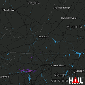 ROANOKE (KFCX) RADAR

