This weather event on May 6, 2024 includes:
5 states
32 counties,
9 cities,
and 79 zip codes.
There were total properties that were impacted and have possible damage.
States Impacted By Hail On May 6, 2024
Kentucky
·
Ohio
·
Tennessee
·
Virginia
·
West Virginia
Counties Impacted By Hail On May 6, 2024
Carter, KY
·
Clay, KY
·
Elliott, KY
·
Floyd, KY
·
Greenup, KY
·
Harlan, KY
·
Johnson, KY
·
Knott, KY
·
Lawrence, KY
·
Lee, KY
·
Leslie, KY
·
Letcher, KY
·
Lewis, KY
·
Magoffin, KY
·
Morgan, KY
·
Owsley, KY
·
Perry, KY
·
Pike, KY
·
Rowan, KY
·
Athens, OH
·
Jackson, OH
·
Lawrence, OH
·
Meigs, OH
·
Washington, OH
·
Hancock, TN
·
Hawkins, TN
·
Dickenson, VA
·
Lee, VA
·
Norton, VA
·
Scott, VA
·
Wise, VA
·
Cabell, WV
Cities Impacted By Hail On May 6, 2024
Chesapeake, OH
·
Clinchport, VA
·
Devola, OH
·
Grayson, KY
·
Huntington, WV
·
Mayking, KY
·
Norton, VA
·
Prestonsburg, KY
·
Wise, VA
Zip Codes Impacted By Hail On May 6, 2024
24221
·
24228
·
24244
·
24251
·
24263
·
24273
·
24277
·
24293
·
25504
·
25701
·
25705
·
37731
·
37765
·
37869
·
40351
·
40828
·
40843
·
40914
·
40927
·
40962
·
40972
·
41135
·
41141
·
41142
·
41143
·
41144
·
41164
·
41166
·
41171
·
41175
·
41179
·
41180
·
41204
·
41216
·
41222
·
41230
·
41238
·
41240
·
41254
·
41255
·
41263
·
41264
·
41274
·
41311
·
41314
·
41421
·
41465
·
41472
·
41501
·
41540
·
41559
·
41607
·
41616
·
41649
·
41653
·
41701
·
41712
·
41714
·
41722
·
41739
·
41815
·
41824
·
41836
·
41843
·
41855
·
41858
·
45619
·
45640
·
45645
·
45669
·
45678
·
45686
·
45692
·
45696
·
45724
·
45741
·
45744
·
45750
·
45778
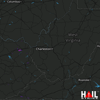 CHARLESTON (KRLX) RADAR

