This weather event on May 2, 2024 includes:
3 states
15 counties,
21 cities,
and 65 zip codes.
There were 123 total properties that were impacted and have possible damage.
States Impacted By Hail On May 2, 2024
Indiana
·
Michigan
·
Ohio
Counties Impacted By Hail On May 2, 2024
Allen, IN
·
DeKalb, IN
·
Elkhart, IN
·
Kosciusko, IN
·
LaGrange, IN
·
Noble, IN
·
Steuben, IN
·
Whitley, IN
·
Hillsdale, MI
·
Lenawee, MI
·
Defiance, OH
·
Paulding, OH
·
Putnam, OH
·
Van Wert, OH
·
Williams, OH
Cities Impacted By Hail On May 2, 2024
Angola, IN
·
Cloverdale, OH
·
Dupont, OH
·
Edgerton, OH
·
Edon, OH
·
Fort Wayne, IN
·
Goshen, IN
·
Grabill, IN
·
Hicksville, OH
·
Hoagland, IN
·
Kalida, OH
·
Leo-Cedarville, IN
·
Ligonier, IN
·
Millersburg, IN
·
New Haven, IN
·
North Adams, MI
·
Paulding, OH
·
Topeka, IN
·
Tri-Lakes, IN
·
Van Wert, OH
·
Wolcottville, IN
Zip Codes Impacted By Hail On May 2, 2024
43518
·
43526
·
43543
·
45821
·
45827
·
45831
·
45832
·
45844
·
45849
·
45853
·
45856
·
45863
·
45873
·
45875
·
45879
·
45891
·
46526
·
46528
·
46543
·
46567
·
46571
·
46701
·
46703
·
46705
·
46710
·
46721
·
46723
·
46725
·
46733
·
46737
·
46741
·
46742
·
46743
·
46745
·
46747
·
46755
·
46761
·
46763
·
46765
·
46767
·
46774
·
46779
·
46784
·
46794
·
46795
·
46802
·
46803
·
46805
·
46806
·
46807
·
46815
·
46816
·
46818
·
46835
·
46845
·
49220
·
49233
·
49242
·
49249
·
49262
·
49282
·
43512
·
43517
·
46788
·
46809
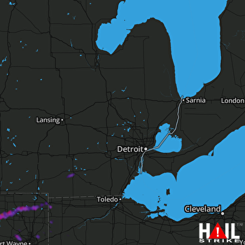 DETROIT (KDTX) RADAR

