This weather event on April 30, 2024 includes:
3 states
24 counties,
17 cities,
and 78 zip codes.
There were 1915 total properties that were impacted and have possible damage.
States Impacted By Hail On April 30, 2024
Iowa
·
Nebraska
·
South Dakota
Counties Impacted By Hail On April 30, 2024
Mills, IA
·
Antelope, NE
·
Burt, NE
·
Butler, NE
·
Cass, NE
·
Cedar, NE
·
Colfax, NE
·
Cuming, NE
·
Dakota, NE
·
Dodge, NE
·
Douglas, NE
·
Johnson, NE
·
Knox, NE
·
Lancaster, NE
·
Otoe, NE
·
Pierce, NE
·
Platte, NE
·
Sarpy, NE
·
Saunders, NE
·
Stanton, NE
·
Thurston, NE
·
Washington, NE
·
Wayne, NE
·
Union, SD
Cities Impacted By Hail On April 30, 2024
Ames, NE
·
Ashland, NE
·
Colon, NE
·
Dodge, NE
·
Douglas, NE
·
Foster, NE
·
Fremont, NE
·
Gretna, NE
·
Howells, NE
·
Leigh, NE
·
Omaha, NE
·
Snyder, NE
·
Syracuse, NE
·
Valley, NE
·
Venice, NE
·
Waterloo, NE
·
Yutan, NE
Zip Codes Impacted By Hail On April 30, 2024
51534
·
51561
·
57025
·
57038
·
68002
·
68003
·
68004
·
68014
·
68015
·
68018
·
68019
·
68022
·
68025
·
68029
·
68031
·
68041
·
68044
·
68045
·
68047
·
68055
·
68064
·
68066
·
68067
·
68069
·
68070
·
68073
·
68304
·
68324
·
68329
·
68336
·
68344
·
68366
·
68407
·
68428
·
68443
·
68446
·
68454
·
68462
·
68514
·
68517
·
68521
·
68527
·
68531
·
68601
·
68621
·
68626
·
68629
·
68631
·
68633
·
68641
·
68642
·
68643
·
68648
·
68649
·
68659
·
68661
·
68717
·
68723
·
68733
·
68740
·
68741
·
68752
·
68756
·
68765
·
68767
·
68768
·
68769
·
68771
·
68779
·
68781
·
68784
·
68786
·
68788
·
68790
·
68791
·
68028
·
68057
·
68664
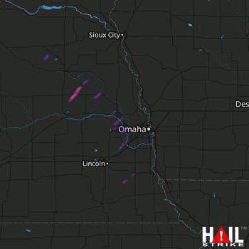 OMAHA (KOAX) RADAR

