This weather event on April 30, 2024 includes:
1 states
18 counties,
24 cities,
and 63 zip codes.
There were total properties that were impacted and have possible damage.
States Impacted By Hail On April 30, 2024
Nebraska
Counties Impacted By Hail On April 30, 2024
Antelope, NE
·
Burt, NE
·
Butler, NE
·
Cass, NE
·
Colfax, NE
·
Cuming, NE
·
Dodge, NE
·
Douglas, NE
·
Johnson, NE
·
Lancaster, NE
·
Otoe, NE
·
Pierce, NE
·
Platte, NE
·
Sarpy, NE
·
Saunders, NE
·
Stanton, NE
·
Washington, NE
·
Wayne, NE
Cities Impacted By Hail On April 30, 2024
Ames, NE
·
Ashland, NE
·
Cedar Bluffs, NE
·
Clarkson, NE
·
Colon, NE
·
Creston, NE
·
Dodge, NE
·
Douglas, NE
·
Foster, NE
·
Fremont, NE
·
Howells, NE
·
King Lake, NE
·
Leigh, NE
·
Leshara, NE
·
Memphis, NE
·
Schuyler, NE
·
Snyder, NE
·
Syracuse, NE
·
Uehling, NE
·
Unadilla, NE
·
Valley, NE
·
Wann, NE
·
Wisner, NE
·
Yutan, NE
Zip Codes Impacted By Hail On April 30, 2024
68057
·
68002
·
68003
·
68014
·
68015
·
68018
·
68019
·
68022
·
68025
·
68028
·
68029
·
68031
·
68040
·
68041
·
68042
·
68044
·
68045
·
68050
·
68063
·
68064
·
68066
·
68069
·
68070
·
68073
·
68301
·
68307
·
68324
·
68336
·
68344
·
68366
·
68417
·
68418
·
68443
·
68446
·
68462
·
68514
·
68517
·
68621
·
68629
·
68631
·
68633
·
68641
·
68642
·
68643
·
68649
·
68659
·
68661
·
68664
·
68716
·
68748
·
68752
·
68756
·
68765
·
68767
·
68768
·
68769
·
68779
·
68781
·
68788
·
68790
·
68791
·
68329
·
68454
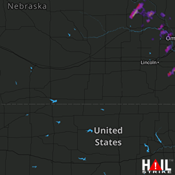 HASTINGS (KUEX) RADAR

