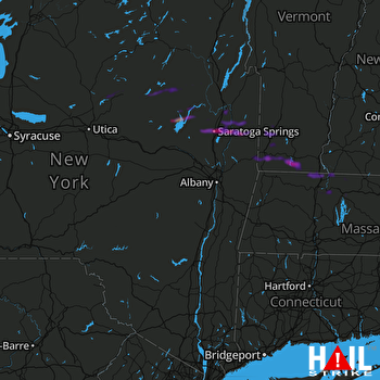
This weather event on April 30, 2024 includes:
4 states
16 counties,
24 cities,
and 79 zip codes.
There were 8197 total properties that were impacted and have possible damage.
States Impacted By Hail On April 30, 2024
Massachusetts
·
New Hampshire
·
New York
·
Vermont
Counties Impacted By Hail On April 30, 2024
Franklin, MA
·
Hampshire, MA
·
Worcester, MA
·
Cheshire, NH
·
Fulton, NY
·
Hamilton, NY
·
Herkimer, NY
·
Oneida, NY
·
Rensselaer, NY
·
Saratoga, NY
·
Seneca, NY
·
Tompkins, NY
·
Warren, NY
·
Washington, NY
·
Bennington, VT
·
Windham, VT
Cities Impacted By Hail On April 30, 2024
Arlington, VT
·
Bennington, VT
·
Greenfield Town, MA
·
Greenwich, NY
·
Hoosick Falls, NY
·
Jacksonville, VT
·
Manchester, VT
·
Millers Falls, MA
·
North Bennington, VT
·
Northfield, MA
·
Northville, NY
·
Old Bennington, VT
·
Readsboro, VT
·
Salem, NY
·
Saratoga Springs, NY
·
Schuylerville, NY
·
South Glens Falls, NY
·
Speculator, NY
·
Trumansburg, NY
·
Turners Falls, MA
·
Victory, NY
·
Wells, NY
·
West Glens Falls, NY
·
Wilmington, VT
Zip Codes Impacted By Hail On April 30, 2024
1031
·
1082
·
1301
·
1331
·
1337
·
1340
·
1342
·
1344
·
1346
·
1347
·
1349
·
1351
·
1355
·
1360
·
1364
·
1367
·
1368
·
1376
·
1378
·
1379
·
1531
·
3451
·
3470
·
5201
·
5250
·
5254
·
5255
·
5257
·
5260
·
5261
·
5262
·
5301
·
5342
·
5350
·
5354
·
5358
·
5361
·
5363
·
12057
·
12089
·
12090
·
12108
·
12117
·
12134
·
12139
·
12164
·
12190
·
12803
·
12804
·
12809
·
12810
·
12816
·
12817
·
12822
·
12823
·
12828
·
12831
·
12833
·
12834
·
12835
·
12839
·
12859
·
12865
·
12866
·
12871
·
12873
·
12878
·
12884
·
13092
·
13324
·
13338
·
13353
·
13438
·
14850
·
14882
·
14886
·
12885
·
12850
·
5252
 ALBANY (KENX) RADAR

