This weather event on April 29, 2024 includes:
2 states
6 counties,
47 cities,
and 51 zip codes.
There were total properties that were impacted and have possible damage.
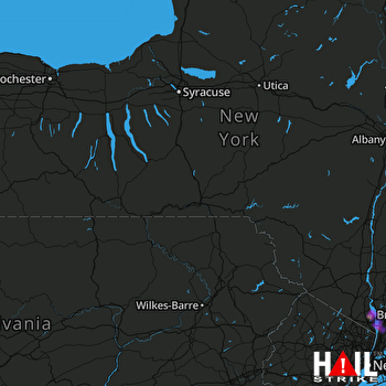 BINGHAMTON (KBGM) RADAR
States Impacted By Hail On April 29, 2024
New Jersey
·
New York
Counties Impacted By Hail On April 29, 2024
Essex, NJ
·
Morris, NJ
·
Sussex, NJ
·
Rockland, NY
·
Sullivan, NY
·
Westchester, NY
Cities Impacted By Hail On April 29, 2024
Ardsley, NY
·
Bardonia, NY
·
Blauvelt, NY
·
Briarcliff Manor, NY
·
Bronxville, NY
·
Caldwell, NJ
·
Congers, NY
·
Croton-on-Hudson, NY
·
Crugers, NY
·
Dobbs Ferry, NY
·
Eastchester, NY
·
Elmsford, NY
·
Essex Fells, NJ
·
Fairview, NY
·
Grand View-on-Hudson, NY
·
Greenville, NY
·
Harrison, NY
·
Hartsdale, NY
·
Haverstraw, NY
·
Irvington, NY
·
Larchmont, NY
·
Mamaroneck, NY
·
Mount Ivy, NY
·
New City, NY
·
New Hempstead, NY
·
New Rochelle, NY
·
Nyack, NY
·
Orangeburg, NY
·
Ossining, NY
·
Pearl River, NY
·
Piermont, NY
·
Port Chester, NY
·
Roseland, NJ
·
Rye, NY
·
Rye Brook, NY
·
Scarsdale, NY
·
Sleepy Hollow, NY
·
South Nyack, NY
·
Stony Point, NY
·
Tarrytown, NY
·
Thiells, NY
·
Tuckahoe, NY
·
Upper Nyack, NY
·
Valley Cottage, NY
·
West Haverstraw, NY
·
West Nyack, NY
·
White Plains, NY
Zip Codes Impacted By Hail On April 29, 2024
7039
·
7068
·
7419
·
7461
·
7936
·
10502
·
10503
·
10520
·
10522
·
10523
·
10528
·
10530
·
10533
·
10538
·
10543
·
10562
·
10570
·
10573
·
10577
·
10580
·
10583
·
10591
·
10595
·
10603
·
10604
·
10605
·
10606
·
10607
·
10707
·
10708
·
10709
·
10801
·
10804
·
10913
·
10920
·
10923
·
10927
·
10956
·
10960
·
10962
·
10968
·
10970
·
10977
·
10989
·
10993
·
10994
·
12785
·
12790
·
7006
·
10510
·
10980

