This weather event on April 27, 2024 includes:
2 states
22 counties,
22 cities,
and 68 zip codes.
There were 5898 total properties that were impacted and have possible damage.
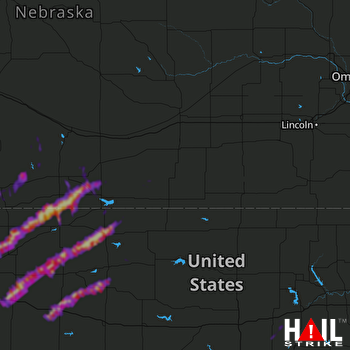 HASTINGS (KUEX) RADAR
States Impacted By Hail On April 27, 2024
Kansas
·
Nebraska
Counties Impacted By Hail On April 27, 2024
Decatur, KS
·
Dickinson, KS
·
Gove, KS
·
Graham, KS
·
Norton, KS
·
Osborne, KS
·
Phillips, KS
·
Rawlins, KS
·
Rooks, KS
·
Sheridan, KS
·
Thomas, KS
·
Trego, KS
·
Adams, NE
·
Dawson, NE
·
Franklin, NE
·
Frontier, NE
·
Furnas, NE
·
Gosper, NE
·
Harlan, NE
·
Phelps, NE
·
Red Willow, NE
·
Webster, NE
Cities Impacted By Hail On April 27, 2024
Beaver City, NE
·
Campbell, NE
·
Detroit, KS
·
Edmond, KS
·
Grainfield, KS
·
Grinnell, KS
·
Hoxie, KS
·
Indianola, NE
·
Logan, KS
·
McCook, NE
·
Norcatur, KS
·
Norton, KS
·
Oberlin, KS
·
Orleans, NE
·
Oxford, NE
·
Palco, KS
·
Phillipsburg, KS
·
Prairie View, KS
·
Stamford, NE
·
Stockton, KS
·
WaKeeney, KS
·
Zurich, KS
Zip Codes Impacted By Hail On April 27, 2024
67410
·
67431
·
67441
·
67448
·
67451
·
67621
·
67622
·
67623
·
67625
·
67631
·
67632
·
67635
·
67637
·
67639
·
67642
·
67643
·
67645
·
67646
·
67647
·
67650
·
67653
·
67654
·
67656
·
67657
·
67659
·
67661
·
67663
·
67664
·
67669
·
67672
·
67675
·
67737
·
67738
·
67740
·
67748
·
67749
·
67751
·
67752
·
67753
·
67757
·
68920
·
68922
·
68926
·
68927
·
68928
·
68932
·
68936
·
68939
·
68946
·
68949
·
68966
·
68967
·
68972
·
68977
·
68981
·
68982
·
69001
·
69020
·
69022
·
69028
·
69029
·
69034
·
69036
·
69046
·
68971
·
68929
·
67629
·
66951

