This weather event on April 27, 2024 includes:
2 states
21 counties,
16 cities,
and 49 zip codes.
There were 1954 total properties that were impacted and have possible damage.
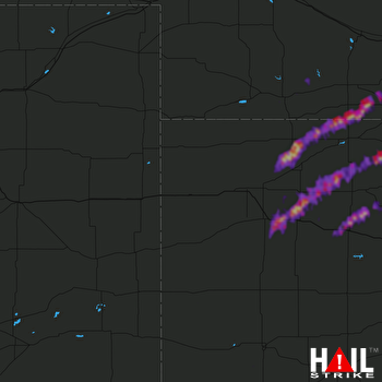 GOODLAND (KGLD) RADAR
States Impacted By Hail On April 27, 2024
Kansas
·
Nebraska
Counties Impacted By Hail On April 27, 2024
Decatur, KS
·
Finney, KS
·
Gove, KS
·
Graham, KS
·
Grant, KS
·
Greeley, KS
·
Logan, KS
·
Morton, KS
·
Norton, KS
·
Phillips, KS
·
Rawlins, KS
·
Rooks, KS
·
Sheridan, KS
·
Stanton, KS
·
Thomas, KS
·
Trego, KS
·
Wichita, KS
·
Frontier, NE
·
Furnas, NE
·
Harlan, NE
·
Red Willow, NE
Cities Impacted By Hail On April 27, 2024
Edmond, KS
·
Greeley County unified government (balance), KS
·
Grinnell, KS
·
Hoxie, KS
·
Johnson City, KS
·
Logan, KS
·
Morland, KS
·
Norcatur, KS
·
Oberlin, KS
·
Palco, KS
·
Phillipsburg, KS
·
Speed, KS
·
Stamford, NE
·
Ulysses, KS
·
WaKeeney, KS
·
Zurich, KS
Zip Codes Impacted By Hail On April 27, 2024
67622
·
67625
·
67629
·
67631
·
67635
·
67637
·
67639
·
67642
·
67643
·
67645
·
67646
·
67650
·
67653
·
67654
·
67656
·
67657
·
67659
·
67661
·
67663
·
67664
·
67669
·
67672
·
67737
·
67738
·
67740
·
67748
·
67749
·
67751
·
67752
·
67753
·
67757
·
67846
·
67855
·
67861
·
67862
·
67879
·
67880
·
67953
·
68926
·
68946
·
68967
·
68977
·
69001
·
69020
·
69022
·
69034
·
69046
·
68966
·
67632

