This weather event on April 27, 2024 includes:
2 states
20 counties,
23 cities,
and 63 zip codes.
There were 2726 total properties that were impacted and have possible damage.
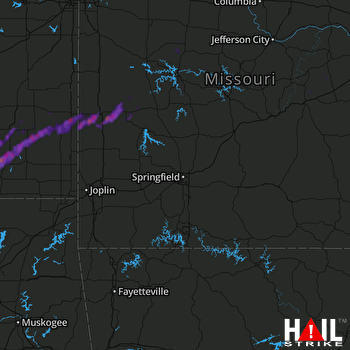 SPRINGFIELD (KSGF) RADAR
States Impacted By Hail On April 27, 2024
Kansas
·
Missouri
Counties Impacted By Hail On April 27, 2024
Allen, KS
·
Bourbon, KS
·
Chautauqua, KS
·
Crawford, KS
·
Labette, KS
·
Montgomery, KS
·
Neosho, KS
·
Wilson, KS
·
Woodson, KS
·
Bates, MO
·
Benton, MO
·
Cedar, MO
·
Crawford, MO
·
Gasconade, MO
·
Henry, MO
·
Maries, MO
·
Pettis, MO
·
Phelps, MO
·
St. Clair, MO
·
Vernon, MO
Cities Impacted By Hail On April 27, 2024
Altoona, KS
·
Chanute, KS
·
Coyville, KS
·
Deerfield, MO
·
El Dorado Springs, MO
·
Elk City, KS
·
Erie, KS
·
Fort Scott, KS
·
Fredonia, KS
·
Galesburg, KS
·
Harwood, MO
·
Hepler, KS
·
Independence, KS
·
Ionia, MO
·
Milo, MO
·
Moundville, MO
·
Neodesha, KS
·
Nevada, MO
·
Roscoe, MO
·
Savonburg, KS
·
Stark, KS
·
Thayer, KS
·
Warsaw, MO
Zip Codes Impacted By Hail On April 27, 2024
64728
·
64738
·
64741
·
64744
·
64750
·
64767
·
64770
·
64771
·
64772
·
64776
·
64778
·
64779
·
64781
·
64783
·
64784
·
64790
·
65066
·
65301
·
65325
·
65335
·
65338
·
65355
·
65360
·
65401
·
65453
·
65550
·
65559
·
66701
·
66710
·
66711
·
66714
·
66717
·
66720
·
66732
·
66733
·
66734
·
66736
·
66740
·
66741
·
66746
·
66748
·
66749
·
66751
·
66755
·
66757
·
66769
·
66771
·
66772
·
66775
·
66776
·
66777
·
66779
·
66783
·
67047
·
67301
·
67335
·
67341
·
67344
·
67347
·
67363
·
66780
·
65332
·
64780

