This weather event on April 26, 2024 includes:
2 states
16 counties,
25 cities,
and 43 zip codes.
There were 224 total properties that were impacted and have possible damage.
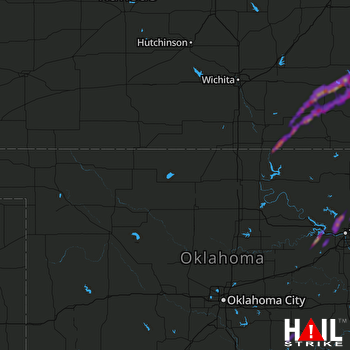 VANCE AFB (KVNX) RADAR
States Impacted By Hail On April 26, 2024
Kansas
·
Oklahoma
Counties Impacted By Hail On April 26, 2024
Chautauqua, KS
·
Cowley, KS
·
Elk, KS
·
Greenwood, KS
·
Wilson, KS
·
Woodson, KS
·
Creek, OK
·
Kay, OK
·
Nowata, OK
·
Osage, OK
·
Pawnee, OK
·
Pottawatomie, OK
·
Rogers, OK
·
Seminole, OK
·
Tulsa, OK
·
Washington, OK
Cities Impacted By Hail On April 26, 2024
Benedict, KS
·
Bowlegs, OK
·
Bushyhead, OK
·
Collinsville, OK
·
Elk Falls, KS
·
Fall River, KS
·
Fredonia, KS
·
Grenola, KS
·
Limestone, OK
·
Mannford, OK
·
Moline, KS
·
New Albany, KS
·
Oologah, OK
·
Owasso, OK
·
Sand Springs, OK
·
Sapulpa, OK
·
Sequoyah, OK
·
Severy, KS
·
Skiatook, OK
·
Sperry, OK
·
Toronto, KS
·
Tulsa, OK
·
Turley, OK
·
Vera, OK
·
Westport, OK
Zip Codes Impacted By Hail On April 26, 2024
66714
·
66717
·
66736
·
66777
·
66783
·
67005
·
67023
·
67024
·
67038
·
67047
·
67122
·
67137
·
67345
·
67349
·
67352
·
67353
·
74010
·
74016
·
74017
·
74019
·
74020
·
74021
·
74048
·
74053
·
74055
·
74063
·
74066
·
74070
·
74073
·
74080
·
74117
·
74126
·
74127
·
74130
·
74647
·
74830
·
74849
·
74854
·
74868
·
74884
·
74044
·
67346
·
67019

