This weather event on April 26, 2024 includes:
2 states
19 counties,
35 cities,
and 59 zip codes.
There were 2182 total properties that were impacted and have possible damage.
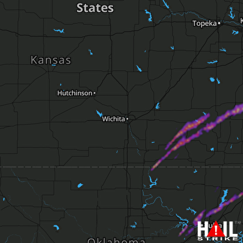 WICHITA (KICT) RADAR
States Impacted By Hail On April 26, 2024
Kansas
·
Oklahoma
Counties Impacted By Hail On April 26, 2024
Allen, KS
·
Bourbon, KS
·
Chautauqua, KS
·
Cowley, KS
·
Elk, KS
·
Greenwood, KS
·
Linn, KS
·
Neosho, KS
·
Wilson, KS
·
Woodson, KS
·
Craig, OK
·
Creek, OK
·
Kay, OK
·
Mayes, OK
·
Nowata, OK
·
Osage, OK
·
Pawnee, OK
·
Rogers, OK
·
Tulsa, OK
Cities Impacted By Hail On April 26, 2024
Benedict, KS
·
Blue Mound, KS
·
Bronson, KS
·
Buffalo, KS
·
Bushyhead, OK
·
Cedar Vale, KS
·
Chelsea, OK
·
Collinsville, OK
·
Coyville, KS
·
Elk Falls, KS
·
Elsmore, KS
·
Fall River, KS
·
Fredonia, KS
·
Grenola, KS
·
Humboldt, KS
·
Limestone, OK
·
Mannford, OK
·
Mapleton, KS
·
Moline, KS
·
Moran, KS
·
New Albany, KS
·
Oologah, OK
·
Owasso, OK
·
Sand Springs, OK
·
Sapulpa, OK
·
Sequoyah, OK
·
Severy, KS
·
Skiatook, OK
·
Sperry, OK
·
Tulsa, OK
·
Turley, OK
·
Uniontown, KS
·
Vinita, OK
·
Westport, OK
·
White Oak, OK
Zip Codes Impacted By Hail On April 26, 2024
66010
·
66014
·
66056
·
66701
·
66710
·
66714
·
66716
·
66717
·
66720
·
66732
·
66736
·
66748
·
66749
·
66751
·
66754
·
66755
·
66769
·
66772
·
66777
·
66779
·
66783
·
67005
·
67019
·
67023
·
67024
·
67038
·
67047
·
67122
·
67345
·
67346
·
67349
·
67352
·
67353
·
74010
·
74016
·
74019
·
74020
·
74021
·
74042
·
74044
·
74048
·
74053
·
74055
·
74063
·
74066
·
74070
·
74072
·
74073
·
74080
·
74117
·
74126
·
74127
·
74130
·
74301
·
74332
·
74647
·
74652
·
74017
·
67137

