This weather event on April 26, 2024 includes:
3 states
17 counties,
13 cities,
and 60 zip codes.
There were 21 total properties that were impacted and have possible damage.
States Impacted By Hail On April 26, 2024
Iowa
·
Kansas
·
Missouri
Counties Impacted By Hail On April 26, 2024
Taylor, IA
·
Allen, KS
·
Anderson, KS
·
Bourbon, KS
·
Coffey, KS
·
Labette, KS
·
Linn, KS
·
Miami, KS
·
Montgomery, KS
·
Neosho, KS
·
Wilson, KS
·
Woodson, KS
·
Bates, MO
·
Henry, MO
·
Johnson, MO
·
Lafayette, MO
·
Vernon, MO
Cities Impacted By Hail On April 26, 2024
Blue Mound, KS
·
Chanute, KS
·
Chilhowee, MO
·
Earlton, KS
·
Hartwell, MO
·
Higginsville, MO
·
Mound Valley, KS
·
Neosho Falls, KS
·
Parsons, KS
·
Piqua, KS
·
Thayer, KS
·
Urich, MO
·
Warrensburg, MO
Zip Codes Impacted By Hail On April 26, 2024
50833
·
50848
·
51646
·
64019
·
64020
·
64021
·
64022
·
64037
·
64040
·
64067
·
64071
·
64076
·
64093
·
64724
·
64726
·
64728
·
64730
·
64733
·
64735
·
64752
·
64761
·
64767
·
64770
·
64771
·
64772
·
64778
·
64779
·
64784
·
64788
·
65336
·
66010
·
66014
·
66015
·
66039
·
66040
·
66053
·
66056
·
66071
·
66072
·
66710
·
66716
·
66717
·
66720
·
66748
·
66749
·
66755
·
66758
·
66761
·
66776
·
66783
·
66857
·
67301
·
67330
·
67335
·
67341
·
67342
·
67354
·
67357
·
66083
·
66757
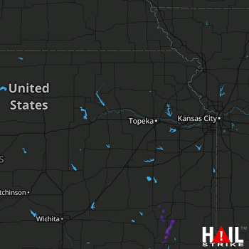 TOPEKA (KTWX) RADAR

