This weather event on April 25, 2024 includes:
2 states
21 counties,
16 cities,
and 48 zip codes.
There were 705 total properties that were impacted and have possible damage.
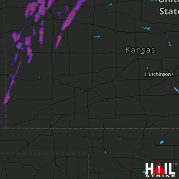 DODGE CITY (KDDC) RADAR
States Impacted By Hail On April 25, 2024
Colorado
·
Kansas
Counties Impacted By Hail On April 25, 2024
Baca, CO
·
Prowers, CO
·
Decatur, KS
·
Gove, KS
·
Graham, KS
·
Greeley, KS
·
Hamilton, KS
·
Lane, KS
·
Logan, KS
·
Morton, KS
·
Norton, KS
·
Phillips, KS
·
Rawlins, KS
·
Scott, KS
·
Sheridan, KS
·
Sherman, KS
·
Stafford, KS
·
Stanton, KS
·
Thomas, KS
·
Wallace, KS
·
Wichita, KS
Cities Impacted By Hail On April 25, 2024
Brewster, KS
·
Colby, KS
·
Gem, KS
·
Goodland, KS
·
Grainfield, KS
·
Greeley County unified government (balance), KS
·
Horace, KS
·
Jennings, KS
·
Lenora, KS
·
Leoti, KS
·
Levant, KS
·
Park, KS
·
Russell Springs, KS
·
Sharon Springs, KS
·
Syracuse, KS
·
Tribune, KS
Zip Codes Impacted By Hail On April 25, 2024
67622
·
67629
·
67635
·
67642
·
67643
·
67645
·
67646
·
67650
·
67653
·
67654
·
67661
·
67664
·
67701
·
67730
·
67732
·
67733
·
67734
·
67735
·
67736
·
67737
·
67738
·
67740
·
67743
·
67744
·
67747
·
67748
·
67749
·
67751
·
67753
·
67757
·
67758
·
67761
·
67762
·
67764
·
67836
·
67850
·
67855
·
67861
·
67862
·
67863
·
67871
·
67878
·
67879
·
67953
·
81029
·
81047
·
81090
·
67578

