This weather event on April 25, 2024 includes:
2 states
21 counties,
19 cities,
and 76 zip codes.
There were 566 total properties that were impacted and have possible damage.
States Impacted By Hail On April 25, 2024
Kansas
·
Oklahoma
Counties Impacted By Hail On April 25, 2024
Butler, KS
·
Chase, KS
·
Chautauqua, KS
·
Cowley, KS
·
Dickinson, KS
·
Elk, KS
·
Greenwood, KS
·
Harvey, KS
·
Kingman, KS
·
Lyon, KS
·
Marion, KS
·
Morris, KS
·
Reno, KS
·
Saline, KS
·
Sedgwick, KS
·
Sumner, KS
·
Woodson, KS
·
Kay, OK
·
Osage, OK
·
Payne, OK
·
Washington, OK
Cities Impacted By Hail On April 25, 2024
Cedar Point, KS
·
Chautauqua, KS
·
Cottonwood Falls, KS
·
Eureka, KS
·
Florence, KS
·
Grenola, KS
·
Gypsum, KS
·
Howard, KS
·
Leon, KS
·
Lincolnville, KS
·
Matfield Green, KS
·
Mulvane, KS
·
Sedgwick, KS
·
Shidler, OK
·
Stillwater, OK
·
Strong City, KS
·
Tampa, KS
·
Toronto, KS
·
Virgil, KS
Zip Codes Impacted By Hail On April 25, 2024
66777
·
66783
·
66801
·
66838
·
66843
·
66845
·
66850
·
66851
·
66852
·
66853
·
66858
·
66859
·
66861
·
66862
·
66863
·
66865
·
66866
·
66869
·
66870
·
67005
·
67008
·
67010
·
67012
·
67013
·
67017
·
67019
·
67023
·
67024
·
67025
·
67026
·
67037
·
67038
·
67039
·
67042
·
67045
·
67050
·
67072
·
67074
·
67108
·
67110
·
67114
·
67120
·
67122
·
67123
·
67132
·
67133
·
67135
·
67144
·
67146
·
67147
·
67154
·
67156
·
67334
·
67346
·
67349
·
67360
·
67361
·
67410
·
67416
·
67438
·
67448
·
67449
·
67483
·
74022
·
74029
·
74056
·
74074
·
74075
·
74078
·
74633
·
74647
·
74652
·
67475
·
67353
·
67001
·
66840
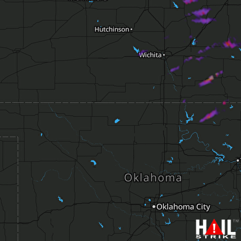 VANCE AFB (KVNX) RADAR

