This weather event on April 25, 2024 includes:
2 states
16 counties,
21 cities,
and 67 zip codes.
There were 3057 total properties that were impacted and have possible damage.
States Impacted By Hail On April 25, 2024
Arkansas
·
Oklahoma
Counties Impacted By Hail On April 25, 2024
Conway, AR
·
Crawford, AR
·
Faulkner, AR
·
Franklin, AR
·
Jefferson, AR
·
Johnson, AR
·
Logan, AR
·
Lonoke, AR
·
Perry, AR
·
Pope, AR
·
Pulaski, AR
·
Saline, AR
·
Sebastian, AR
·
Washington, AR
·
Yell, AR
·
Adair, OK
Cities Impacted By Hail On April 25, 2024
Altus, AR
·
Avilla, AR
·
Bell, OK
·
Cammack Village, AR
·
Cedarville, AR
·
Coal Hill, AR
·
College Station, AR
·
Dardanelle, AR
·
Denning, AR
·
Little Rock, AR
·
Maumelle, AR
·
Mountainburg, AR
·
Mulberry, AR
·
Natural Steps, AR
·
North Little Rock, AR
·
Paris, AR
·
Pottsville, AR
·
Russellville, AR
·
Salem, OK
·
Scott, AR
·
Wiederkehr Village, AR
Zip Codes Impacted By Hail On April 25, 2024
72001
·
72002
·
72016
·
72024
·
72025
·
72046
·
72103
·
72106
·
72113
·
72114
·
72116
·
72117
·
72118
·
72120
·
72122
·
72126
·
72135
·
72142
·
72168
·
72201
·
72202
·
72204
·
72205
·
72206
·
72207
·
72209
·
72210
·
72211
·
72212
·
72223
·
72227
·
72717
·
72729
·
72753
·
72801
·
72802
·
72821
·
72824
·
72832
·
72833
·
72834
·
72835
·
72840
·
72851
·
72853
·
72855
·
72857
·
72858
·
72863
·
72865
·
72921
·
72928
·
72930
·
72932
·
72933
·
72934
·
72941
·
72943
·
72946
·
72947
·
72948
·
72949
·
72951
·
72952
·
72955
·
74948
·
74960
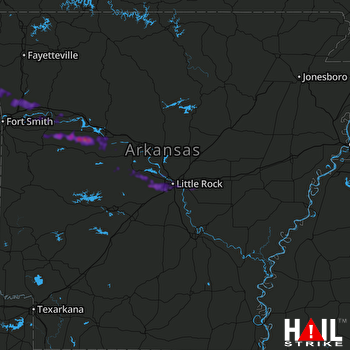 LITTLE ROCK (KLZK) RADAR

