This weather event on April 20, 2024 includes:
2 states
31 counties,
24 cities,
and 70 zip codes.
There were 474 total properties that were impacted and have possible damage.
States Impacted By Hail On April 20, 2024
Oklahoma
·
Texas
Counties Impacted By Hail On April 20, 2024
Comanche, OK
·
Cotton, OK
·
Tillman, OK
·
Archer, TX
·
Baylor, TX
·
Clay, TX
·
Collin, TX
·
Cooke, TX
·
Cottle, TX
·
Denton, TX
·
Fisher, TX
·
Foard, TX
·
Grayson, TX
·
Hardeman, TX
·
Haskell, TX
·
Jack, TX
·
Jones, TX
·
King, TX
·
Knox, TX
·
Montague, TX
·
Palo Pinto, TX
·
Parker, TX
·
Shackelford, TX
·
Stephens, TX
·
Stonewall, TX
·
Tarrant, TX
·
Throckmorton, TX
·
Wichita, TX
·
Wilbarger, TX
·
Wise, TX
·
Young, TX
Cities Impacted By Hail On April 20, 2024
Aubrey, TX
·
Azle, TX
·
Briar, TX
·
Bridgeport, TX
·
Celina, TX
·
Chico, TX
·
Decatur, TX
·
Denton, TX
·
Electra, TX
·
Frederick, OK
·
Goree, TX
·
Gunter, TX
·
Millsap, TX
·
Mineral Wells, TX
·
Pecan Acres, TX
·
Pelican Bay, TX
·
Pilot Point, TX
·
Reno, TX
·
Runaway Bay, TX
·
Sanctuary, TX
·
Sanger, TX
·
Seymour, TX
·
Tioga, TX
·
Valley View, TX
Zip Codes Impacted By Hail On April 20, 2024
73017
·
73528
·
73530
·
73541
·
73542
·
73546
·
73553
·
75009
·
75058
·
76020
·
76052
·
76066
·
76067
·
76073
·
76082
·
76085
·
76179
·
76227
·
76230
·
76234
·
76247
·
76249
·
76258
·
76266
·
76271
·
76272
·
76351
·
76354
·
76360
·
76363
·
76364
·
76365
·
76366
·
76367
·
76370
·
76371
·
76372
·
76374
·
76379
·
76380
·
76384
·
76388
·
76389
·
76424
·
76426
·
76427
·
76431
·
76450
·
76458
·
76459
·
76460
·
76481
·
76483
·
79227
·
79236
·
79248
·
79252
·
79502
·
79503
·
79505
·
79529
·
79533
·
79543
·
79544
·
79546
·
79547
·
79548
·
79521
·
79225
·
76225
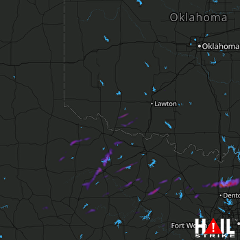 ALTUS AFB (KFDR) RADAR

