This weather event on April 19, 2024 includes:
2 states
15 counties,
29 cities,
and 43 zip codes.
There were 3709 total properties that were impacted and have possible damage.
States Impacted By Hail On April 19, 2024
Alabama
·
Georgia
Counties Impacted By Hail On April 19, 2024
Calhoun, AL
·
Cherokee, AL
·
Cleburne, AL
·
Etowah, AL
·
Jefferson, AL
·
Shelby, AL
·
Chattooga, GA
·
Cherokee, GA
·
Floyd, GA
·
Gilmer, GA
·
Gordon, GA
·
Gwinnett, GA
·
Haralson, GA
·
Murray, GA
·
Pickens, GA
Cities Impacted By Hail On April 19, 2024
Ballplay, AL
·
Broomtown, AL
·
Carlisle-Rockledge, AL
·
Coats Bend, AL
·
Dunnavant, AL
·
Edwardsville, AL
·
Fruithurst, AL
·
Gadsden, AL
·
Glencoe, AL
·
Hokes Bluff, AL
·
Irondale, AL
·
Jacksonville, AL
·
Leeds, AL
·
Lookout Mountain, AL
·
Lyerly, GA
·
Mountain Brook, AL
·
Nances Creek, AL
·
Norcross, GA
·
Peachtree Corners, GA
·
Piedmont, AL
·
Ranger, GA
·
Reece City, AL
·
Shoal Creek, AL
·
Spring Garden, AL
·
Tidmore Bend, AL
·
Vandiver, AL
·
Westover, AL
·
White Plains, AL
·
Whitesboro, AL
Zip Codes Impacted By Hail On April 19, 2024
30071
·
30092
·
30124
·
30139
·
30143
·
30147
·
30161
·
30165
·
30175
·
30176
·
30183
·
30536
·
30540
·
30701
·
30705
·
30730
·
30734
·
30735
·
30747
·
35094
·
35147
·
35205
·
35210
·
35212
·
35213
·
35217
·
35222
·
35242
·
35901
·
35904
·
35905
·
35954
·
35956
·
35973
·
36207
·
36262
·
36264
·
36265
·
36269
·
36272
·
36279
·
35903
·
35206
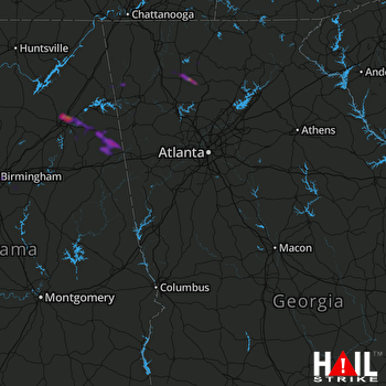 ATLANTA (KFFC) RADAR

