This weather event on September 20, 2026 includes:
2 states
33 counties,
21 cities,
and 77 zip codes.
There were total properties that were impacted and have possible damage.
States Impacted By Hail On September 20, 2026
Kansas
·
Missouri
Counties Impacted By Hail On September 20, 2026
Barton, KS
·
Butler, KS
·
Chase, KS
·
Chautauqua, KS
·
Cowley, KS
·
Dickinson, KS
·
Elk, KS
·
Ellsworth, KS
·
Franklin, KS
·
Harvey, KS
·
Marion, KS
·
McPherson, KS
·
Morris, KS
·
Osage, KS
·
Ottawa, KS
·
Reno, KS
·
Rice, KS
·
Riley, KS
·
Russell, KS
·
Saline, KS
·
Sedgwick, KS
·
Stafford, KS
·
Sumner, KS
·
Wilson, KS
·
Bates, MO
·
Caldwell, MO
·
Carroll, MO
·
Cass, MO
·
Henry, MO
·
Jackson, MO
·
Johnson, MO
·
Lafayette, MO
·
Livingston, MO
Cities Impacted By Hail On September 20, 2026
Archie, MO
·
Blue Springs, MO
·
Braymer, MO
·
Clearwater, KS
·
Falun, KS
·
Garden City, MO
·
Haysville, KS
·
Hoisington, KS
·
Howard, KS
·
Hutchinson, KS
·
Lake Lafayette, MO
·
McPherson, KS
·
Moline, KS
·
Mulvane, KS
·
Oxford, KS
·
Salina, KS
·
Smolan, KS
·
Sterling, KS
·
Udall, KS
·
Wichita, KS
·
Winfield, KS
Zip Codes Impacted By Hail On September 20, 2026
64014
·
64029
·
64040
·
64064
·
64076
·
64624
·
64633
·
64668
·
64701
·
64720
·
64725
·
64726
·
64733
·
64739
·
64747
·
66076
·
66451
·
66528
·
66736
·
66843
·
66851
·
66866
·
67005
·
67019
·
67023
·
67024
·
67026
·
67038
·
67039
·
67047
·
67060
·
67103
·
67110
·
67114
·
67119
·
67120
·
67122
·
67131
·
67137
·
67146
·
67149
·
67151
·
67156
·
67215
·
67227
·
67346
·
67349
·
67353
·
67401
·
67416
·
67422
·
67425
·
67427
·
67442
·
67443
·
67444
·
67448
·
67449
·
67456
·
67457
·
67460
·
67464
·
67484
·
67491
·
67501
·
67502
·
67512
·
67524
·
67525
·
67526
·
67544
·
67546
·
67554
·
67573
·
67579
·
67634
·
67665
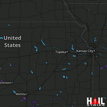 TOPEKA (KTWX) RADAR